
The future of nautical charts is on the horizon
News 2026-10-23
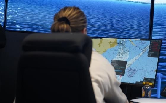
For the past two years, the Swedish Maritime Administration has been working intensively on the EU project Baltic Sea e-nav. By developing, testing and producing the first products in accordance with the new S-100 standards for navigational products, the project is laying the foundation for more dynamic and precise navigation.
To facilitate development and ensure the coordinated introduction of the new nautical chart standards in the Baltic Sea, the Swedish Maritime Administration is leading the Baltic Sea e-Nav project. Funded by Interreg Baltic Sea Region, the project brings together partner countries around the Baltic Sea to begin implementing the next generation of digital products. The partnership consists of hydrographic offices from across the Baltic Sea region, working closely with academia and bridge system manufacturers to take the products from development and testing through to implementation.
— Our ambition is to make commercial nautical chart data available in the new formats during the year. These formats will eventually replace many of the older standards currently in use, including the widely used S-57 standard, which forms the basis of today’s electronic nautical charts, says Carina Stål, Project Manager.
Laying the groundwork
The foundation of future nautical charts is the new S-101 standard, which enables the 3D visualisation of depth data and the display of dynamic information, such as water levels and surface currents, within the same interface. Oskar Müller is a cartographic engineer responsible for implementing the new standard for electronic nautical charts, as well as sharing knowledge and experience with the Swedish Maritime Administration’s project partners.
— To ensure safe navigation in the Baltic Sea, transitions between nautical charts, for example at national borders, must be seamless. This places high demands on us to produce data in a consistent way. There are also clear benefits to sharing experiences during implementation, allowing us to learn from each other’s working methods and become more efficient, explains Oskar, continuing:
— When it comes to ensuring quality for both data producers and end users, the simulator tests carried out within the project have been extremely valuable. We have learned a great deal about how S-101 data interacts with other S-100 data to ensure that the end user receives a fully functional product.
Simulator tests ensure sustainable solutions
The Baltic Sea e-Nav project aims to promote safe, efficient and sustainable digital navigation solutions in the Baltic Sea region. This means that the solutions developed must be user-friendly, making simulator tests an important source of information for evaluating how the products perform in practice. In October 2025, a second round of testing was carried out at the simulator facility of SAMK (Satakunta University of Applied Sciences) in Rauma, focusing on route planning and the practical use of S-100 data products. The new formats are tested in realistic scenarios, providing valuable insights into how the datasets can support navigation using the nautical charts of the future.
In March 2026, tests will be carried out on board Aurora Bothnia, which operates between Umeå and Vaasa.
— Implementation has so far progressed according to plan, although challenges remain in accelerating production in the new formats. For the Swedish Maritime Administration, the focus in 2026 will be on refining and streamlining production, says Oskar Müller.
Next steps
Just over a year remains of the project, and there is still much work to be done. At the same time, the Swedish Maritime Administration is looking ahead to the next stage of S-100 implementation. Caroline Johansson, Business Development Officer, explains:
— Baltic Sea e-Nav is just the beginning, and we will not reach full commercial production of all the standards included in the project. We therefore need to start planning a follow-up project focusing on dynamic data, and this is best done in collaboration with others. Together with several other stakeholders, we have submitted an application for a joint EU project covering the Öresund, Kattegat and Skagerrak.
On the fourth floor of the Swedish Maritime Administration’s headquarters in Norrköping, work continues to enable parallel production of depth data in the new ENC format. The nautical charts of the future are almost here.
