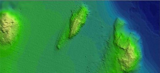
Hydrographic survey data
Hydrographic survey data gathered within Swedish waters is stored in a database at the SMA. Together with modern data collected by laser and multibeam there are also older hand line soundings.

The main use for depth data at the SMA is the production of contours and soundings for sea charts but also the positioning of navigational aids and fairway markings. As modern surveys are very detailed the information can even be used for analyses in connection with fairway design and environmental improvement projects.
High resolution depth data can be used, for example, in environmental analysis, habitat modelling and offshore development such as wind farms. Depth data together with other data is invaluable in regard to the planning of undersea cables and pipelines etc.
As depth information is classified all usage is scrutinized by the Ministry of defense. In certain cases confidential information may be released if the customer signs an agreement to treat the data according to security regulations.
Unreduced depth data:
Unreduced depth data is data taken directly from the database. Modern data has often a density of several hundred points per square metre which can quickly result in an extremely large amount of data .
Gridded depth data:
Data amounts can be reduced by extracting gridded data showing max, min, and/or mean depth within a defined grid square. Standard grids are 2m, 10m, 20m, 100m and 300m. Customized gridded data can also be arranged.
Delivery format can be Shape, ArcGIS-raster and ArcGIS-TIN.
For information on available surveys relevant to your requirements and prices please contact:
Business Area Hydrography Sales department
Tfn: +46 10-478 5810
E-mail: sma@sjofartsverket.se
Read more
Last updated 2021-08-19